
Commercial Aerial Solutions | Mapping & Inspection Services

precise geospatial data and structural analysis for enterprise-level projects.
Comprehensive Aerial Solutions: Integrating Mapping, Inspection, and Surveying Technologies
Introduction to Advanced Aerial Solutions
Modern industries require precise, rapid data acquisition. Unmanned Aerial Vehicles (UAVs) and advanced sensor payloads have transformed conventional data collection, offering comprehensive Aerial Solutions for sectors ranging from construction to agriculture. By leveraging enterprise-grade drones, organizations can execute complex operations with unprecedented accuracy and safety.
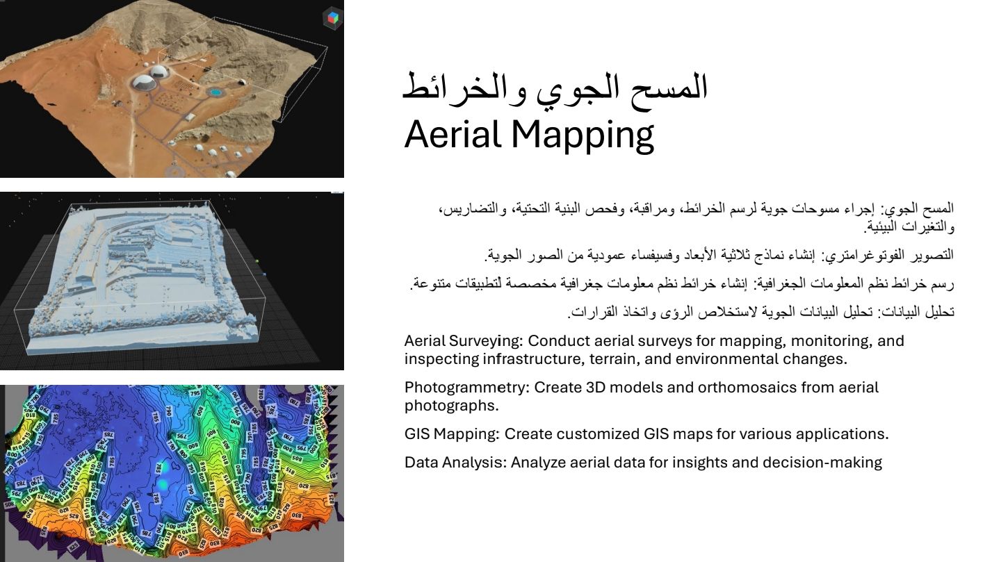
Precision Aerial Survey and Mapping
Accurate geospatial data is the foundation of site planning and development. An aerial survey utilizes high-resolution cameras and advanced sensors to capture detailed topographical data. This data is processed through photogrammetry software to facilitate aerial mapping.
Key sub-disciplines include:
- LiDAR Scanning: Generating highly accurate 3D terrain models and point clouds, even through dense vegetation.
- Photogrammetry: Creating georeferenced orthomosaic maps and digital elevation models (DEMs).
- Topographical Mapping: Providing vital contour data for civil engineering and urban planning.
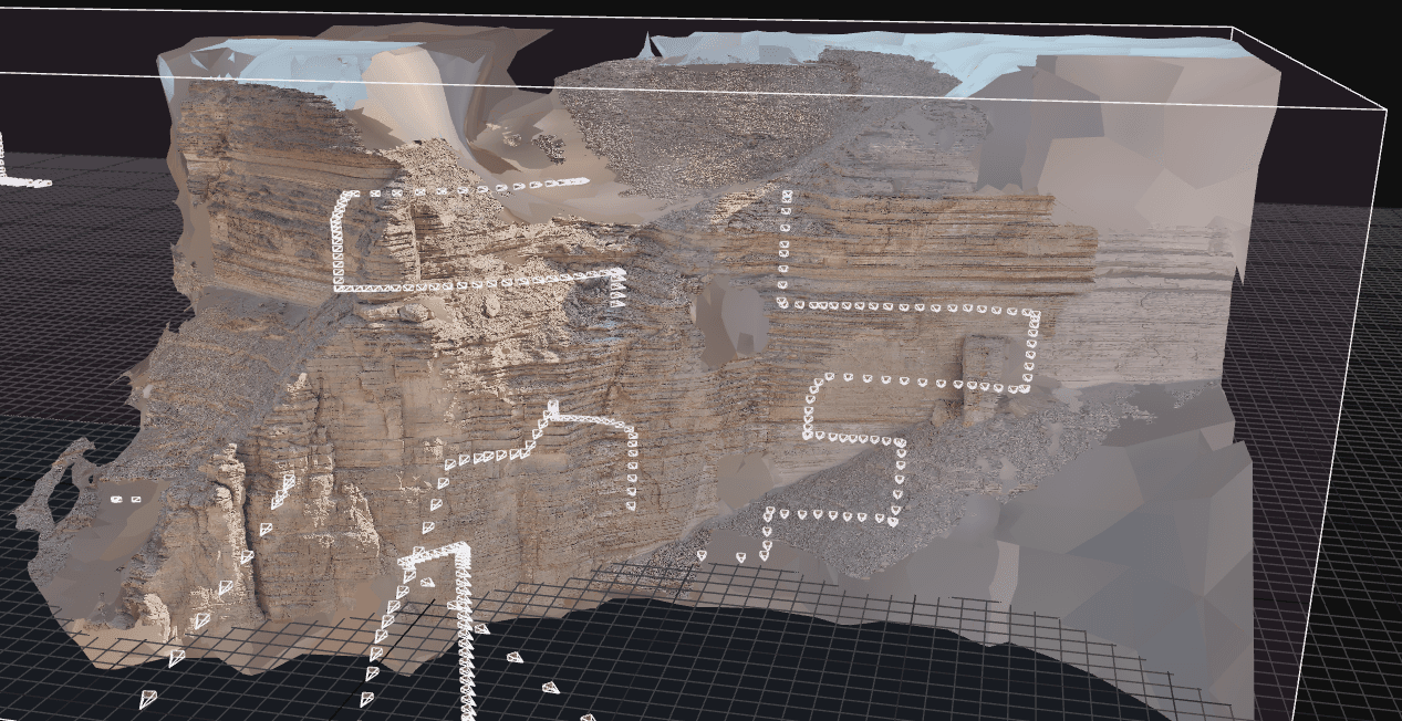
Industrial Aerial Inspection and Analysis
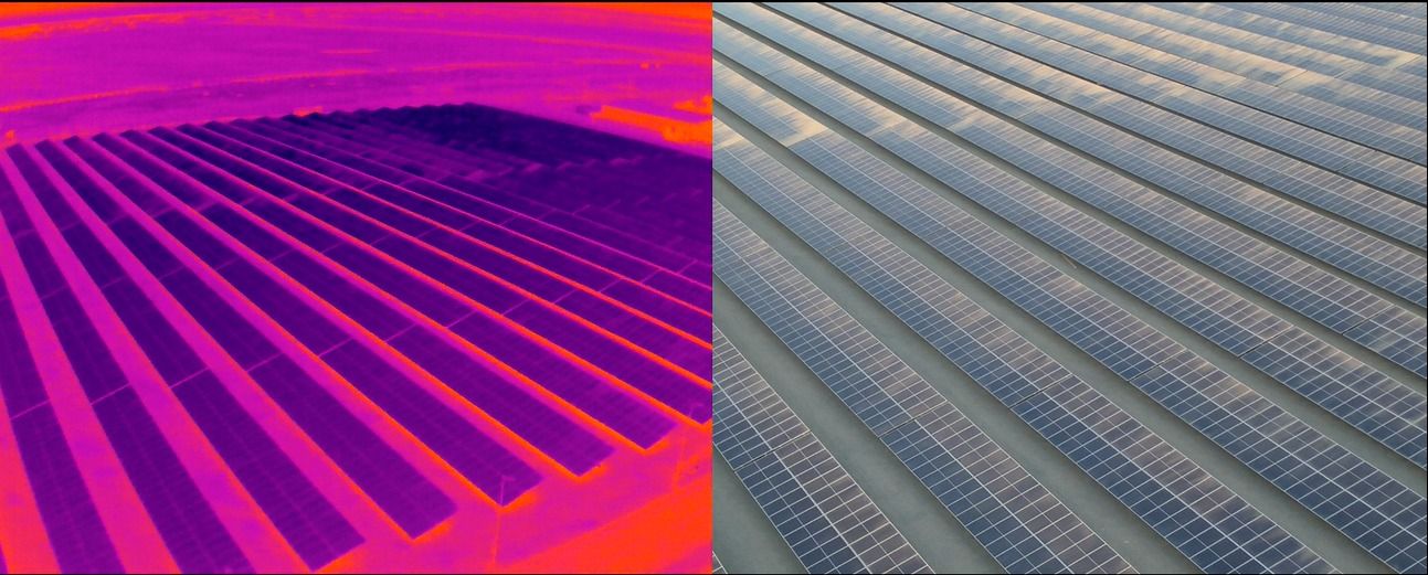
Routine asset monitoring is critical for operational efficiency and risk mitigation. Aerial inspection eliminates the physical risks associated with manual checks on high-altitude or hazardous structures.
- Thermal Aerial Inspection: Utilizing radiometric infrared sensors to detect heat anomalies, structural stress, or energy leaks in solar farms, pipelines, and building envelopes.
- Visual Asset Inspection: Deploying high-zoom payloads for detailed examination of wind turbines, telecom towers, and power grids.
Specialized Agricultural and Security Applications
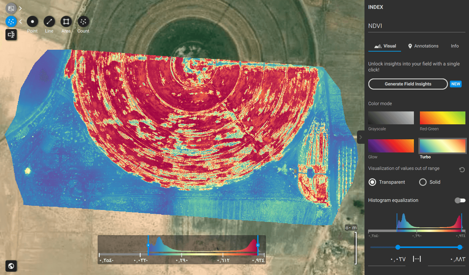
Data-driven decision-making extends directly to land management and perimeter defense.
- Agricultural Survey: Utilizing drone technology for precision agriculture. This involves multispectral imaging to calculate the Normalized Difference Vegetation Index (NDVI), allowing farmers to assess crop health, optimize irrigation, and manage yield estimates.
- Aerial Security and Monitoring: Deploying tethered or automated drone fleets for continuous surveillance. This provides real-time situational awareness, rapid incident response, and perimeter monitoring for critical infrastructure.
Professional Aerial Photography

Beyond technical data collection, high-fidelity visual documentation remains essential. Commercial aerial photography and videography serve dual purposes: providing clear visual updates for construction progress tracking (BIM integration) and delivering high-impact marketing assets for real estate and corporate portfolios.
Conclusion & Recommendations
To remain competitive in the Saudi construction and industrial sectors, integrating UAV technology is no longer optional. Majed Aerial Solutions recommends a phased integration of aerial data into your existing GIS workflows to ensure maximum ROI and project transparency.
