
A Comprehensive Guide to Aerial Mapping in Saudi Arabia
Understanding Aerial Mapping
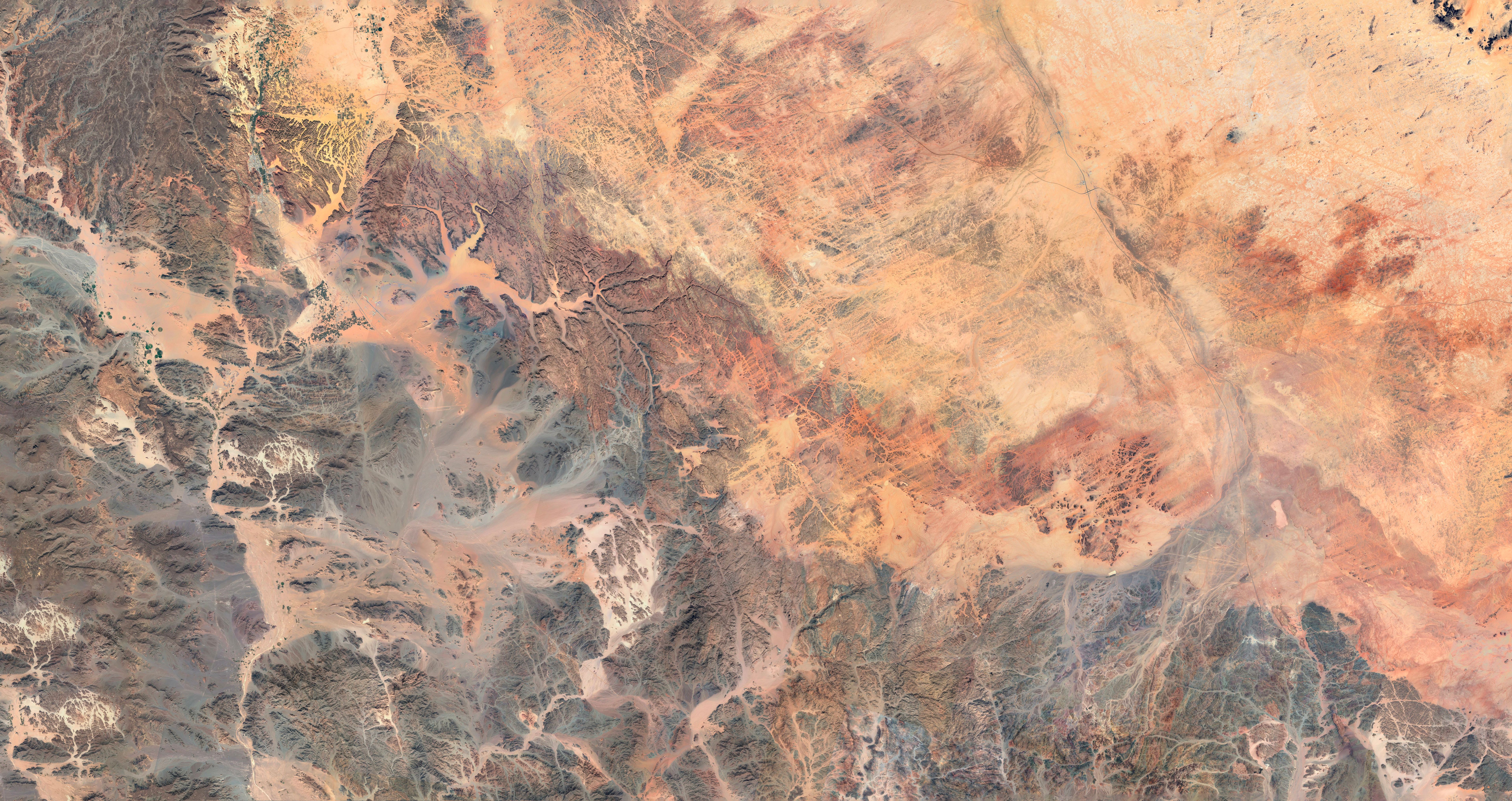
Aerial mapping is a powerful tool used to capture vast areas of land from above, providing detailed images and data. In Saudi Arabia, this technology is transforming industries such as agriculture, urban planning, and environmental monitoring. By using drones and aircraft equipped with advanced cameras and sensors, aerial mapping offers precise and efficient ways to gather geographical data.
The advantage of aerial mapping lies in its ability to cover large areas quickly while maintaining high accuracy. This makes it invaluable for projects that require detailed topographical information or land analysis.
Technological Advances in Aerial Mapping
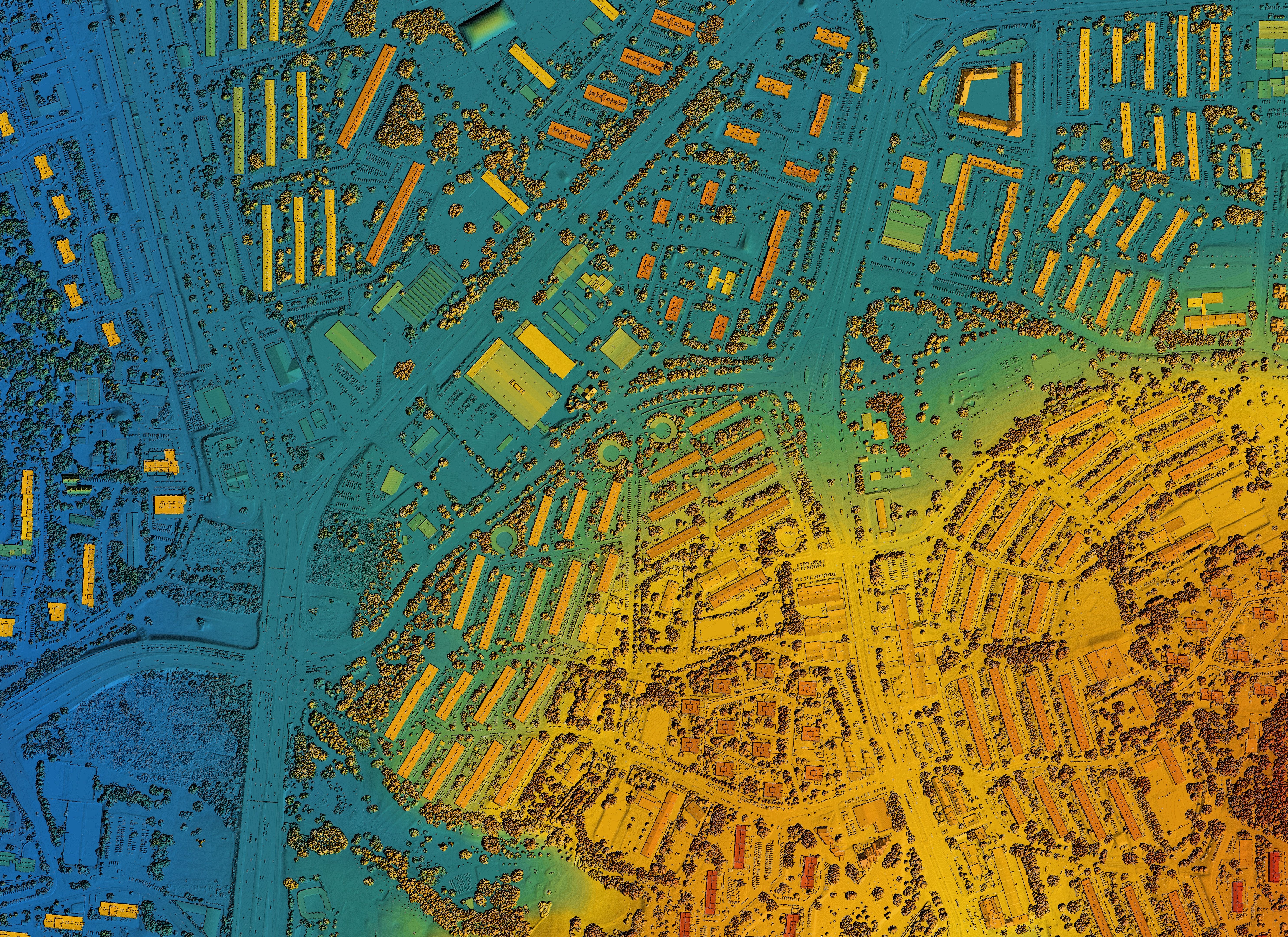
Recent advancements in technology have significantly enhanced aerial mapping capabilities in Saudi Arabia. The integration of GPS, LiDAR, and high-resolution cameras allows for more accurate and detailed data collection. These technologies enable the creation of 3D models and detailed maps that are critical for infrastructure development and environmental management.
Moreover, the use of drones has revolutionized the field, making it more accessible and cost-effective. Drones can fly lower and slower than manned aircraft, capturing images with greater detail and precision.
Applications of Aerial Mapping
Aerial mapping is utilized across various sectors in Saudi Arabia. In agriculture, it helps in monitoring crop health, assessing irrigation systems, and managing land resources. Urban planners use aerial maps to design sustainable cities, while environmentalists rely on them for monitoring ecosystems and wildlife habitats.
Benefits for Infrastructure Development
For infrastructure development, aerial mapping provides essential data for planning and construction. It helps in identifying suitable locations for roads, bridges, and buildings, ensuring that projects are completed efficiently and safely. This is crucial in a rapidly developing country like Saudi Arabia, where large-scale projects are continually underway.

Challenges and Considerations
While aerial mapping offers numerous benefits, it also presents certain challenges. Weather conditions, airspace regulations, and the need for skilled operators can impact the success of mapping projects. It's essential for organizations to work with experienced professionals who understand the nuances of aerial mapping in Saudi Arabia.
Furthermore, ensuring data privacy and security is crucial, as aerial mapping involves capturing sensitive geographical information.

Future Prospects of Aerial Mapping
The future of aerial mapping in Saudi Arabia looks promising. With continued technological advancements and increasing demand across sectors, the scope for innovation is vast. As the country invests in smart city initiatives and environmental conservation, aerial mapping will play a critical role in shaping sustainable development.
In conclusion, aerial mapping is a transformative tool that offers significant advantages for various industries in Saudi Arabia. By embracing this technology, the nation can ensure more efficient and informed decision-making processes.